


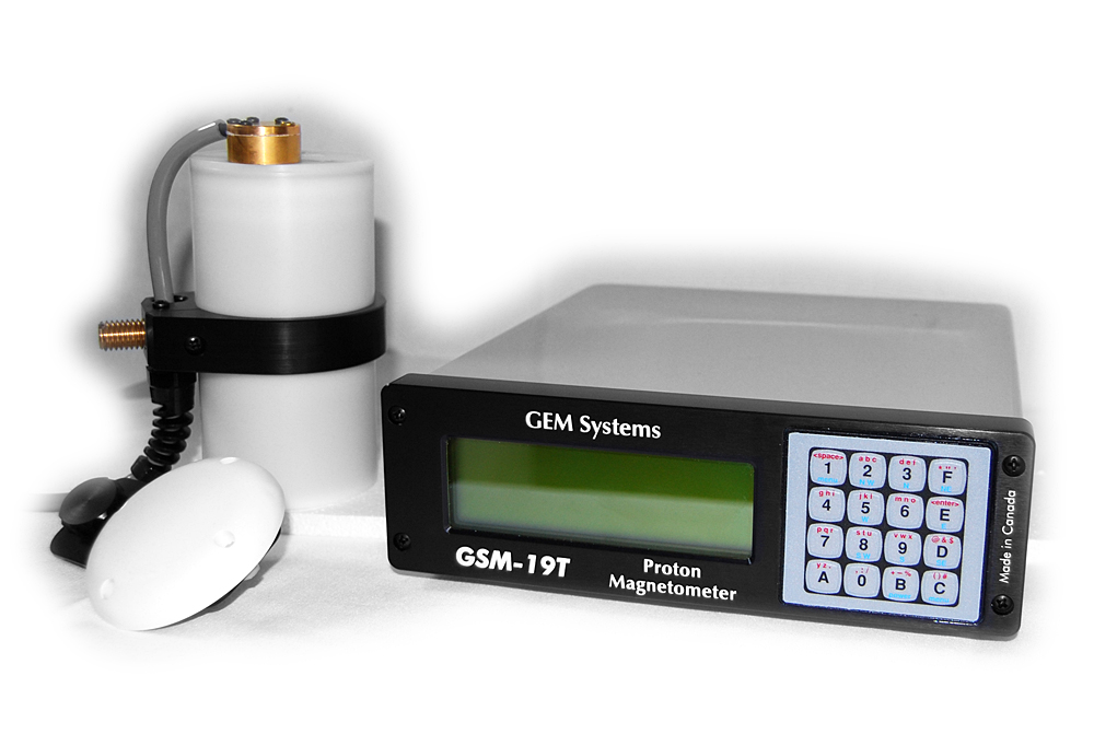
The magnetometer GSM-19 V7.0 Overhauser(GEM, Canada) is used for ground-based magnetic surveys.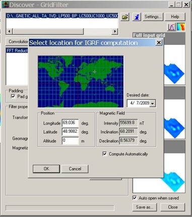
Field data are interpreted using the MapInfo Discover and ZOND2D application. The magnetic field is led to the pole (vertical magnetization-RTP).
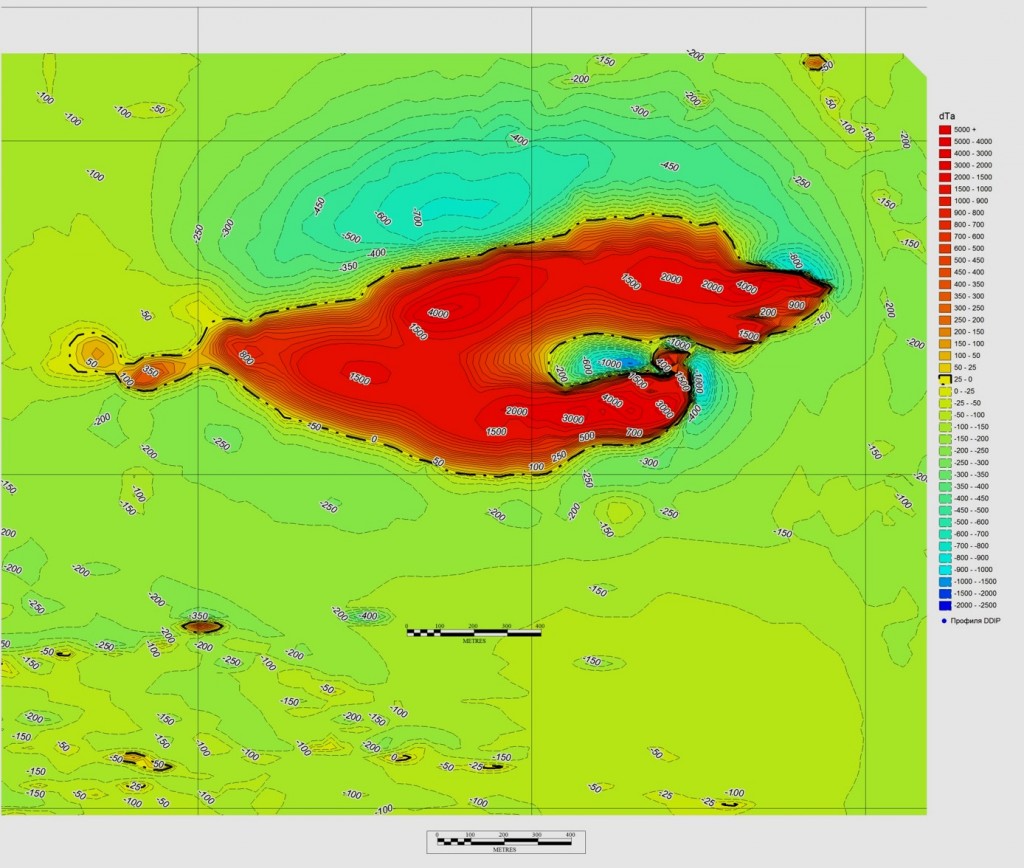
Example work.
Mapping of titanium magnetite deposits at Tymlay field, Kazakhstan.
The figure on the left shows a map of an anomalous magnetic field, not leading to vertical magnetization. Intense positive anomaly mapping the titanium magnetite. The presence of a negative magnetic anomaly north of positive suggests a fall of the magneto-deflecting object south.
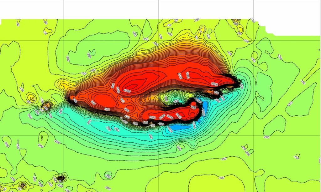
The figure on the right shows the map of the anomalous magnetic field leading to the pole (RTP).
In contrast to the previous pattern, the negative magnetic anomaly is located south of the positive anomaly, indicating a northern fall of the object.
This has been successfully verified by drilling.
The unmanned aerial vehicle DJI Matrice 600 is a universal device equipped with six intelligent batteries and a power management system. This ensures fast configuration and maximum platform efficiency. The UAV is not able to make long flights during the coupling with the power supply, but at the same time it is able to perform tasks autonomously for a long period of time, providing real time image to the display. The A3 Pro flight controller is equipped with three blocks of inertial navigation systems and a global navigation satellite system (GNSS), allowing it to read and compare flight data in real time. The flight controller self-adaptation system automatically adjusts flight parameters depending on the current load.
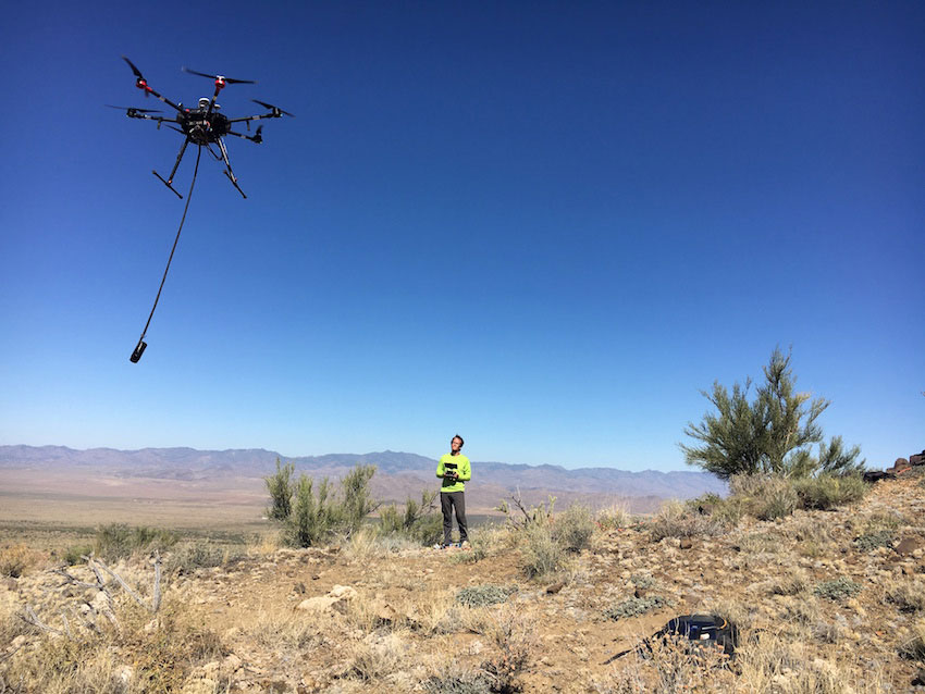
Measurements are made by new generation aeromagnetometers.
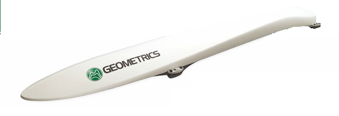
MagArrowIII (Geometrics, USA) is the second-best-selling Geometrics magnetometer. MagArrow is a fully autonomous sensor (with built-in GPS receiver, data logger and battery) and can be used with any suitable UAV capable of carrying 1 kg.
The GSMP-35U (GEM, Canada) is the first magnetometer specifically designed for use in unmanned aerial vehicles (UAVs) that is light and highly sensitive. 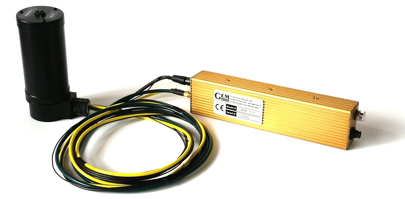
Based on the popular GEM-pumped potassium magnetometer sensor, the sensors provide outstanding sensitivity, absolute accuracy and gradient resistance, making them industry leading. The 0.2 pT potassium magnetometer is the basis for GEM solutions for UAVs.
The program uses UgCS Expert software.![]()
Gamma-ray Spectrometry imaging is performed using the RS-125 spectrometer (RSI, Canada).
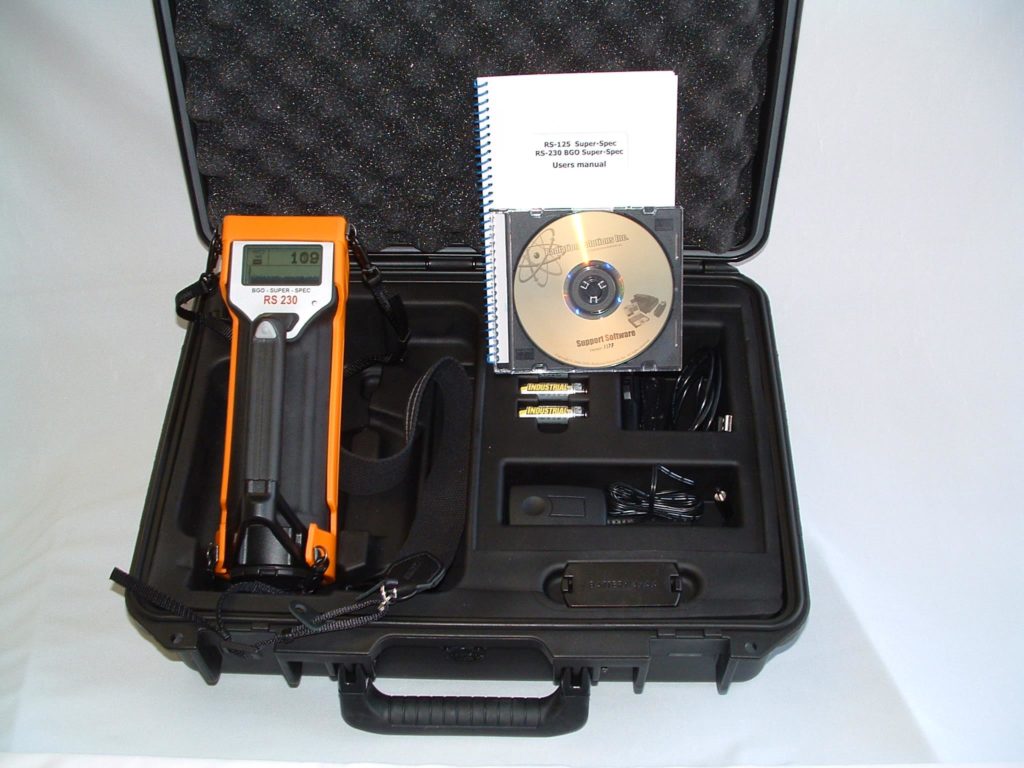
The RS-125 spectrometer is the industry standard for portable devices for geophysical gamma-spectrometric imaging. This integrated large detector device provides survey or search capabilities with direct reading of analysis results, scanning mode and data storage. The RS-125 is weatherproof and easy to use. Bluetooth technology (BT) provides wireless connectivity to compatible devices such as external GPS receiver, headphone or computer.
The interpretation of these gammasecthrometries consists in the mapping of uranium, thorium and potassium isoconcentration and the calculation of potassium domination, which determines the correlation between potassium and thorium concentrations, which records the hydrothermal metasomatic development of the rocks.

We conduct the following methods of electrical surveys:
- Dipole-dipole (pole-dipole) called polarization or geoelectric tomography.
- Induced polarization by the array of the median gradient(VP-SG).
- Vertical Electrical Probe (VEZ)
The following apparatus and equipment is used for conducting electrical reconnaissance:
The measurement of the potential difference in the receiving line was carried out by the portable electric exploration meter EIN-209M, produced by the Institute of Geophysical Research of the National Nuclear Center of the Republic of Kazakhstan.
The current generation in the supply line was carried out using the original equipment: generators GER-2kW-1000V-15A.
In the electric exploration station the field source is a petrol-electric unit «Aksa Generator A BE 110 M» with a capacity of 8.0 kW.

Steel electrodes with a diameter of 15mm and a length of 70cm grouped by 5pcs. on each ground were used as ground supply line AB. Special non-polarizing electrodes of WIRG system were used in MN receiving line. During the installation of the supply and receiving lines, the wire of the GPMCPO was used.
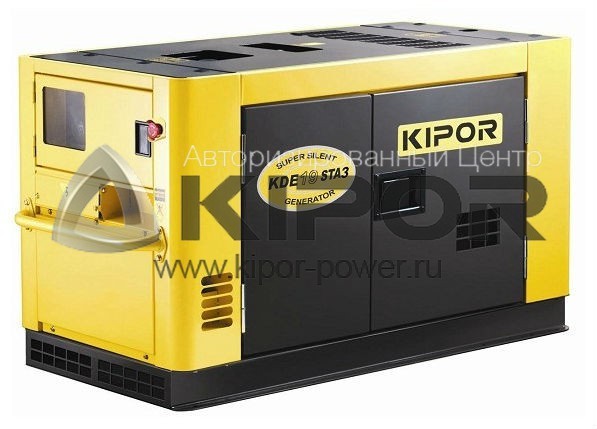
If it is necessary to carry out studies at great depths (500-1000 m and above), in our arsenal there is a diesel generator KIPOR KDE19STA3 with a capacity of 15 kW installed on the car.
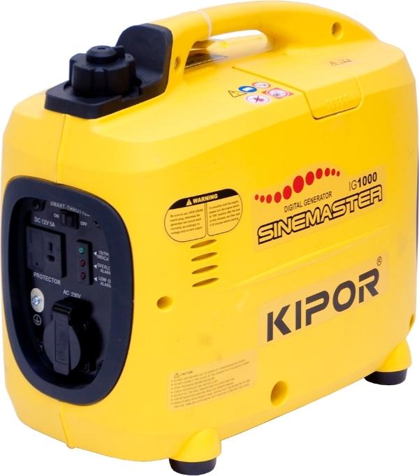
The portable version uses KIPOR IG1000 digital gasoline generators with 1kW capacity.
All generating devices are equipped with original switching devices.
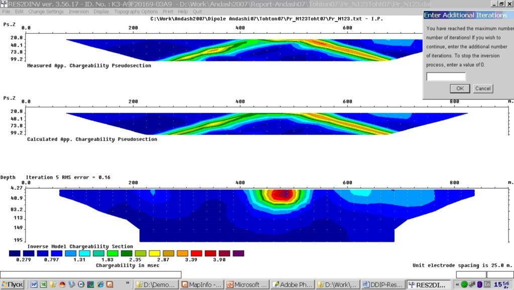
To interpret geoelectric tomography data the RES2DINV (M. Loke) program, created by GEOTOMO SOFTWARE (www.geoelectrical.com).
RES2DINV is a computer program that automatically finds a two-dimensional (2D) or three-dimensional (3D) environment resistance model for data obtained by scanning methods using the least squares method»
The program is widely used in the world geophysical practice. The results of interpretation have a high degree of reliability.
The choice of RES2DINV is justified by the fact that the interpretation method used earlier was based on the interpretation of pseudo-geoelectric cuts, which very often give incorrect information about the structure of the cut. This can be seen in the RES2DINV window below.
Discover3D builds three-dimensional object models.
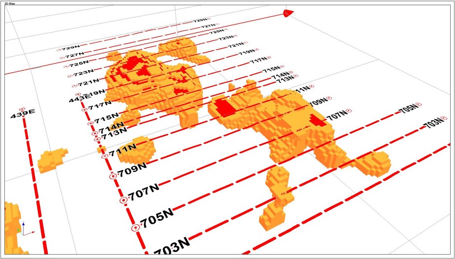
In the picture on the right 3D-model of polarizing objects of the deposit.
Our employees have actively participated in projects of large companies such as BHP Billliton (UK), Azarga Resource (Canada) , as well as in works for PallasResources, KazMinerals, LatonGeoService (Kazahstan) and many others.
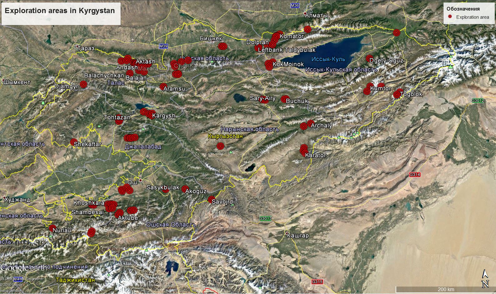
Kyrgyz Republic
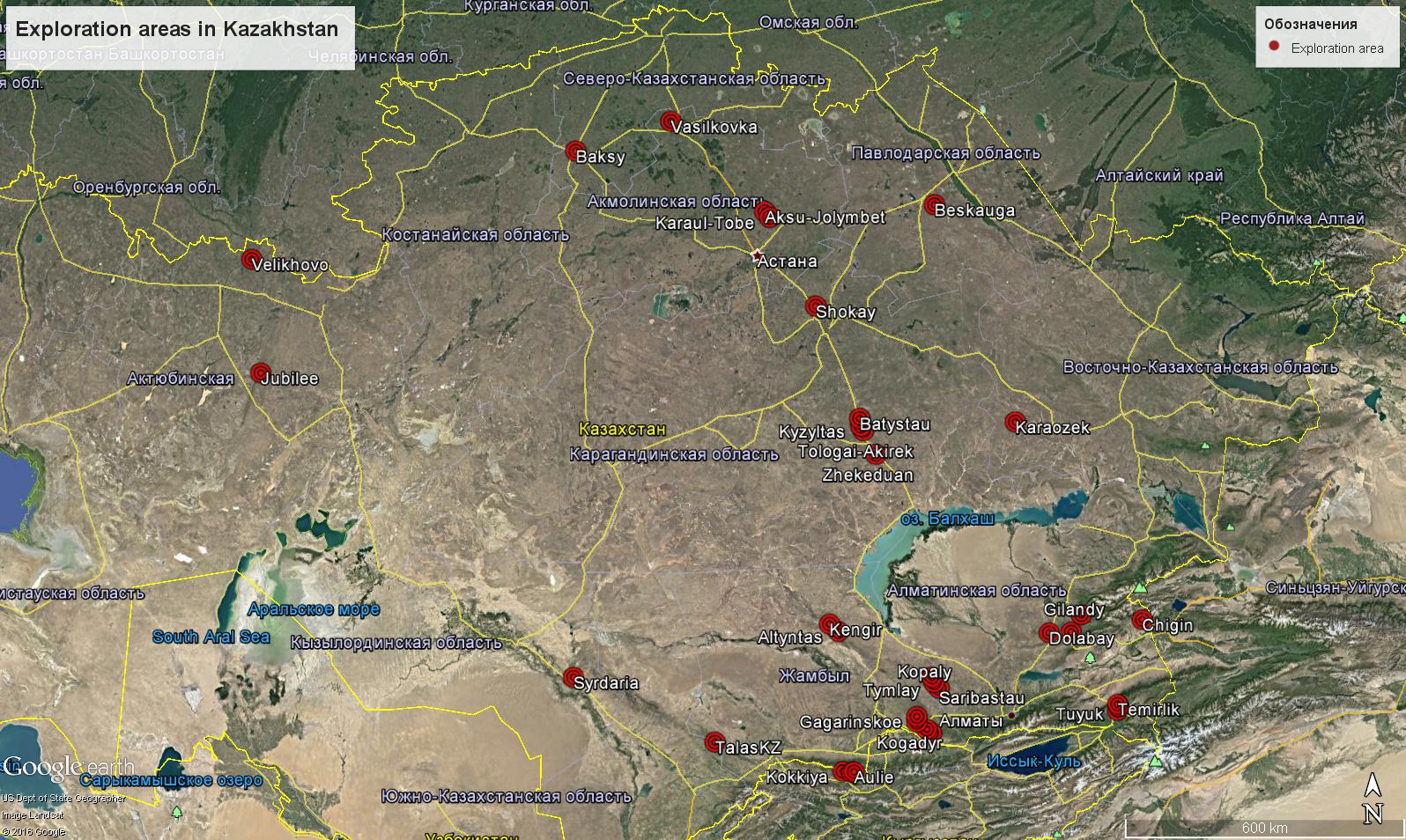
Republic of Kazakhstan
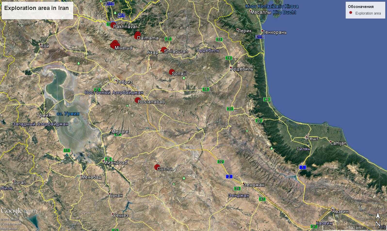
Iran

Phone/WhatsUp
+996 556 211 115

Adres
Kyrgyzstan, Bishkek, st.Umetalieva,11/21

nelin@gg-corp.org